Northwest Montana Ranch for Sale

Ranch for Sale Eureka Montana. www.GraveCreekRanch.com . Montana ranch real estate for sale on 200 acres with grave creek frontage. Gateway to the Ten Lakes Scenic Area and the Back Side of Glacier National Park. Horse Property, Ponds started, Privacy, and Mountain Views.
Montana Ranch Real Estate

Creek Frontage approx. 1400 Feet on Both Sides

www.TenLakesRealty.com


Revett Minerals Flyer

We all got the Flyer to Test our I.Q. on Rock Creek Mine and Revett Minerals.
They say they are "producing vital metals while protecting the environment". A few year back there were studies on this company and what they are REALLY about. Please check out our Northwest Montana Environmental Blog
For Our Archives on Revitt and the Rock Creek Mine, GO To http://www.northwestmt.net/search/label/Rock%20Creek
Revett may be providing Jobs BUT after WR Grace andthe deadly lies Lincoln County has been exposed to in the past,can we afford short term jobs with long term possible health risks,losing our fisheries, polluting our waters, and information that will harm usthat won't surface for years after THEY take the money and run.
They say this is good for the Economy of Northwest MontanaHowever, I wonder if this really is. I know we need jobs butI am not certain that giving tax breaks to big business (Revett Minerals),so we can break the backs of our locals and have future lossof wildlife, fisheries and water quality it the answer.
For information on Tax Incentive Credits check out themeeting minutes for Lincoln Countyat http://www.northwestmt.net/2007/08/northwest-montana-mining_11.html
and at the Lincoln County Sitehttp://www.lincolncountymt.us/minutes.htm
~ ~ ~ ~ ~ ~ ~ ~
So Money is Given to Big Business toCreate Jobs for Lincoln County. Theremust be a better way to create jobs.
I have read the flyer and want to believe whatthey say about fish and inert gases, however,time ALWAYs exposes other issuesand than Big Business has moved on whilethe locals are left to take the heat, the health issuesand the Loss of Lifestyle.
Mining Below Wilderness Lakes is just Wrong.I will NEVER hike in the Cabinet mountains, I willalways know that beneath the surface is mining activitiesthat could harm me and that DO harm the animals.With this it will not Seem Pristine.
If This can happen under a Wilderness than it makesyou want to stand behind Montanans for Multiple Useand those who want the Ten Lakes Scenic are to NOTgo to Wilderness status. If this status makes it so that the areacan be opened up to mining and drilling than I, an advocate of Wildernesssay No to turning the Ten Lakes into a Wilderness area.
I use to think wilderness meant protection for an area.
It does not, it means that Big companies are open for Businesswhere you used to hike, horse ride, snowmobile, and fish.
Revett Mineral does not have a Clean past. Google the company, Researchtheir previous names and what they have REALLY been up to.
Does REVETT Mineral Care about Our WildernessCheck out this Quote and Decide for yourself
"There shouldn't be anything sacred about this spot.Plenty of mines are built in prettier places,a wilderness is just a line on a map."Doug Ward Revett MineralsV.P. Corporate Development
~ ~ ~ ~ ~ ~ ~
Revett Minerals Threatens Our Northwest Montana Lifestyle FOREVER.They threaten the region's water quality and recreation economy, and the sanctity of wilderness areas nationwide.Rock Creek Mine WILL- Drain wilderness lakes in the Cabinet Mountains.- Impair grizzly bear and bull trout recovery efforts.- Cost Montana taxpayers by leaving us to treat water in perpetuity—a multi-million-dollar burden on our children and their children.
For More Information Check Outhttp://www.RockCreekAlliance.org/Lots of Really Good InformationTake the Timeto Read All of their Pagesand you will KNOW the Truth.
~ ~ ~ ~ ~ ~ ~
More Information AT

Once we LOSE the Cabinet Wilderness and PollutionPours into the Clark Fork River and LAKE PEND OREILLEthan we lose Millions of Revenue in folks that want to movehere because it is or WAS pristine here. We lose those whowant to come to Northwest Montana and vacation.Glacier Park brings Millions upon Millions of dollarsto Northwest Montana each year. As we lose timber dollars andlife transitions, our biggest asset is to draw seasonal visitorswho want to be here because it is not like the cities they live in.Northwest Montana being Clean and unpolluted is a BiggerEconomic Gain than a short Term Mine that will causemore damage than good.
~
For More Information Check Out
http://www.RockCreekAlliance.org/
Lots of Really Good InformationTake the Time to Read All of their Pagesand you will KNOW the Truth.
~
More Information AT
http://www.EarthWorksAction.org/rockcreek.cfm
AND
http://www.SaveOurCabinets.org/

AND for FACTS SHEET
http://www.SaveOurCabinets.org/pdf/FactsAndIssues.pdf
~
Folks this is NOT an Environmentalist Protest or stancethis is the FACTS. I have know people who have died horrible deathsdue to WR Grace, and those lies told by this company in effortto "Create Jobs" will haunt the families of Northwest Montana forever.
What you Leave you Children with WILL NOT BE WORTH IT.
More on this Issue at
And AT
http://www.northwestmt.net/search/label/Rock%20Creek

Northwest Montana Internet Marketing

If you are serious about getting your Northwest Montana Business or Services found, you need to advertise online. We are Number One in Northwest Montana. If you want your Northwest Montana Real Estate for Sale by owner or agent, your northwest Montana guide service or anything you want FOUND online than market with us Today. http://www.northwestmontana.com/

Northwest Montana Chocolates

Unique Candy Makers in Northwest Montana.
“These chocolates are not a guilty pleasure, nor a one-time special thing,” explains owner and chocolatier Susan Schnee. “They’re something you can do a little bit every day.” Made with dark cocoa solids and very little sugar, Schnee’s chocolates far outclass other brands in quality and artistry. Copperleaf Chocolate Company on Central Avenue in Whitefish enters the market at a time when health gurus advocate cacao’s benefits and folks lean toward enjoying small portions of distinctive foods rather than super-sized helpings of the mediocre.

Advertising Your Montana Waterfront


Montana Waterfront Real Estate


Announcing

MontanaWaterProperty.com

An Internet Real Estate Search, Marketing and Advertising website for Waterfront Real Estate by Agent and By Owner in Montana. Take a Look ....
www.MontanaWaterProperty.com

Northwest Montana Hiking

WoW, Northwest Montana Bighorn Sheep.
Shot while hiking in Glacier National Park, Northwest Montana.

Northwest Montana Mountain Biking

Mountain Biking Around Lake Koocanusa Northwest Montana
Location: Between Eureka and LibbyType: Road RideRating: ExperiencedMileage: 80miles This 80-mile loop ride is arguably one of the best road riding opportunities in the Big Sky state. When the government created Libby Dam in 1972, they flooded towns and the whole Kootenai River Valley. The monster of a lake created now extends 90 miles upstream with 48 miles in the U.S. and 42miles in Canada. a cyclist's dream. It is difficult to find a level section on this ride...you'll continually find yourself going either up or down and around another bend as the road hugs high above the lake's shore. The hills and the distance earn this ride an Experienced rating.

You can ride on either side of the lake.
You never know what wildlife you will see.
Without a Car you notice alot more and don't spook the critters.
The different smells along the way are wonderful,
pine trees, cottonwood, and all kinds of plant life.
If you Love Mountain Biking, this Really is a Great Ride, and HEY
if you get Hot you can jump in....

Fall is in The Air

Well the crisp morning air has give us a break from the smoke. Fall is such a nice time of year, chilly mornings and warm afternoons. Everybody is hustling around getting ready for the back to school stuff. And preparing to dig back into work. The larch needles starting changing early this year due to the drought conditions. So Fall is here Early.

Northwest Montana Fire Update

Well today I cannot help but Tear up.
The news is reporting the fires, but a day makes over 100 percent difference in growth. Everything I have read on the "official" sites say that the Star Meadows Fire is 16,000 acres, but the daily interlake newspaper says it is 49,000. Another official website says
Report for Brush Creek as of Aug 4, 2007(Wildland Fire Incident)
Area: 15,981 acres (120% increase from yesterday)

Location: Flathead county, MT -
Approximately 25 miles West of Whitefish,

MTCause: LightningTeam Type: 2
Team Leader: J. Koehler0.

0% Contained
Expected Containment: Aug 30, 2007

Now August 30th containment is frightening. Isn't there planes and help around the US to help Northwest Montana Put these fires out. Today, the last I heard the TOWN of Seeley Lake was being evacuted, can you imagine, in the height of tourist season these businessed have to evacuate and remove their valuable, the reports say that SUNDAY afternoon, which now it is 3:36 pm that the fire was fastly moving toward the town and was 1.5 miles away.. my prayers are with them all. It does not Look Good.

The Star Meadows (brushcreek fire) is huge and no containment. i have heard of people who have lost livestock and not to mention the wild animals. How can they breath and the smoke is so thick how will they know which way to go. Some say fire is natural, I have to wonder what I can do to help. I told myself during Katrina that if I lived within an hour of those folks I would help and Here I sit at my computer and there is NOTHING I can do.


Keep Northwest Montana in Your Prayers Folks.
We need Rain Desparately.
There is NO END in sight to these wildfires.
These Folks have lost grazing, lost cattle and their
way of life is changed forever.
PLEASE CHECK BACK TO THIS WEBSITE
WHEN ALL THIS IS OVER IN THE FALL
AND WE WILL LET YOU KNOW
WHAT YOU CAN DO TO HELP
THESE PEOPLE.


Here are some more Good Links for
Northwest Montana Fires Updates


**********
And check out this daily Interlake article...


*******************************

SEELEY LAKE WEB CAM


************************


***********************

WHITEFISH WEB CAM


*********************


GLACIER NATIONAL PARK
WEB CAM DIRECTORY


*************************
WEB CAM DIRECTORY

~FLATHEAD VALLEY
**********
MONTANA WEB CAMS


________________________


FS WebCam BitterRoot Valley Montana
http://www.fsvisimages.com/biva1/biva1.html


______________________________


GLACIER INTERNATIONAL AIRPORT WEBCAM
http://www.glacierwebcam.com/

__________________________


Fire Updates

Well BAD has got Worse.
The fire in the Star Meadows area is now 15,000 plus acres and zero percent containment, people are being made to get out of their homes. It shows no sign of letting up. The Skyland fire in the Glacier Park area is over 30,000 acres and 2% contained... this is just 2 of the many wildfires burning in Northwest Montana. Again, Keep these FOLKs in your prayers.

I hate to be synical, but in a day and age when we can put an apparatus on our head and play a game and the amazing technology we have at our fingertips and we can not put out fires. Why dont we have jets dropping more water, or the weather controlling machines that must exist. When you look at the maps online of the fire you see it was very VERY small and it seems it could have been put out. It does make you wonder.

Check Out the Photos, Maps and Updates at
http://www.inciweb.org/incident/maps/886/


Montana Fire News


Seeley Fire Prompts Evacuation Order
HELENA AP) – Ground crews Saturday were pulled off a new wildfire in western Montana for safety and officials issued an evacuation order for homes in the area of Seeley and Placid lakes, popular vacation getaways northeast of Missoula.The evacuation did not apply to the community of Seeley Lake, a tourist spot with restaurants, lodging and other services."This fire is in the hands of God right now," Gov. Brian Schweitzer said after flying over the blaze in a helicopter Saturday.Fire information officer Jamie Kirby said the blaze that started Friday afternoon was estimated at 5,000 acres Saturday afternoon and had been fanned by winds of 25-30 mph. There were no reports of homes burning, she said.Possibly 200 homes were covered by the evacuation order, according to Kirby, who said she was uncertain about their distance from the fire. They are a mix of year-round and vacation dwellings.Schweitzer urged people to leave without delay."Open the gates, turn the livestock loose, take your pets, shut off the propane at the tank, shut off the electricity and get out," said the governor, who described the fire as burning in "some of the heaviest timber in Montana."The Missoula County Sheriff's Department issued the evacuation order.


Rain. Rain. Please Rain...

Northwest Montana Wildfires


Well another day of Fire Season.

Star Meadows, I heard was evacuated as with Good Creek. I really wish those folks well. Keep them in your Prayers ~ All who read this. Those people may lose their homes. We are all Praying for you. There is no real signs of the fires letting up. I did get fresh are today here in Eureka Montana, it was a welcome sight. I can, However see huge plumes of smoke from the Fire above and around Star Meadows. I will show you those pictures later. For now CNN has a few good videos at http://search.cnn.com/search.jsp?query=montana%20wildfire&type=video&sortBy=date&intl=false

And Don't forget the link for Fire Updates at

I am not sure how often they update, sometimes it seems
by the hour and than it changes, my true feeling is
that they don't want most of us
to know how bad it really is. From where I am,
I do not see how any Person
or animal could possibly breath up there.

It seems as though Fires are everywhere. I read where 200 cows
were killed by fire around Sidney Montana.


MONTANA FIRE NEWS

Red-Flag Conditions Threaten to Stir Up Montana Wildfires
http://www.newwest.net/index.php/topic/article/
red_flag_conditions_threaten_to_whip_up_montana_wildfires/C38/L38/


The Mile Marker 124 Fire east of Missoula. Courtesy of Jamie Kirby of the Montana Department of Natural Resources and Conservation.
UPDATED 7:30 p.m. Montana fires whipped up under red-flag conditions Friday night as a cold front moved across the state, dropping humidity and increasing winds.
Big plumes of smoke were visible on both sides of the continental divide. To the east, the Skyland Fire near Glacier grew, as did the Ahorn fire west of Augusta. To West, the Sawmill Complex east of Missoula flared up, sending a plume of smoke visible from Missoula.
The Skyland Fire, burning near Glacier to the south-southeast between Badger Creek and Two Medicine Creek, grew again Friday as winds blew it away from Highway 2 and to the southeast of Dog Gun Lake. Crews were pulled off for safety reasons and structures in the area have been prepared, but none have been reported lost, according to reports from fire camp.
The Blackfeet Emergency Operations Center issued a mandatory evacuation Friday afternoon along Heart Butte Cutoff Road (BIA Route 2) from US Hwy 2 to BIA Route 1, not including East Glacier or Heart Butte. The Heart Butte Cutoff Road is closed south of Two Medicine Creek. Any questions regarding the evacuation should be directed to the Tribe’s EOC at (406) 338-4099.
Fire officials reported winds on the fire on average of 25 mph and gusting to 31 mph. A Red-flag warning is in effect until midnight.
The most easterly reach of the fire is just past Dog Gun Lake on the Blackfeet Reservation, and to Mule Ridge to the west near Skyland Road. It is 16 miles long and averages 1-2 miles wide. Badger Cabin, a USFS cabin in a Badger Creek tributary south of the fire, has been wrapped with a fire resistant foil. The fire was was still estimated at 19,800 acres Friday at nightfall. Highway 2, which was closed earlier this week, is still open to traffic going both ways.
Ahorn Fire, West of Augusta
The Ahorn Fire, Montana’s largest blaze of the season so far, burning the Bob Marshall Wilderness and Lewis and Clark National Forest 30 miles west of Augusta acted up as well Friday under the same conditions, growing mostly to the east toward Gibson reservoir. Some torching was spotted in the area near the Fish Wildlife and Parks cabin near the reservoir, but with the heavy smoke there’s no way to tell just how far east the blaze has spread, said fire information officer John Daugherty.
The latest acreage estimate was 41,260 acres, but Daugherty said that estimate would likely be bigger in the morning. While the fire grew mostly to the east, it did spread a little on all sides.
Firefighters were worried Thursday that the fire will move into the Goat Creek area south of Gibson, where the terrain “happens to be lined up perfectly for those winds to blow it right into those structures,” fire information officer Bob MacGregor said Thursday.
Crews have been working on structure protection in that area on the one Fish, Wildlife and Parks cabin and several structures, mostly watering and clearing fuel. The areas around the structures are “pretty green” MacGregor said and operations specialists are “quite confident they would survive
To the South of of the fire, there are a number of structures, including about 65 summer lease cabins in the Benchmark area. There, structure protection crews continue to run hose lines and sprinkler systems into the cabins to protect them should the fire move south. The area from the Benchmark Trailhead to the Wood Lake Campground was evacuated last weekend. Evacuations have been ordered in the Stoner area on the east side of the fire, Daugherty said.
Beaver Willow Road is to the east of the fire. To the north, the fire is nearly uncontrollable, but there is a stretch of state and private grasslands to the south of Gibson that could make it a little easier to get ahead of so crews have been scouting the area all week looking for places to dig line.
Firefighting crews will be using fire-line explosives along the crest of Sawtooth Ridge to eliminate fuels on Friday and Saturday. Crews will be starting from the Sun Canyon Road and working south, residents should not be alarmed if they hear some booms, officials say.
The rapid growth of both the Ahorn and the Fool Creek Fires prompted officials on the Lewis and Clark National Forest to close a large part of the Rocky Mountain Ranger District to the public. The closure went into effect early Thursday morning.
The closure area encompasses both wilderness and non-wilderness lands on the Rocky Mountain Ranger District and extends from Highway 2 adjacent to the Badger-Two Medicine area on the north, continuing south along the forest boundary to Observation Point; then east along Petty Crown Creek trail to the Forest boundary; then north along the forest boundary to
Highway 2, then returns west along Highway 2 to the Continental Divide. Smith Creek, Elk Creek and Dearborn trailheads remain open as well as the Smith Creek trail (#215) and the Petty Crown trail (#232). Click here for a full map of the trail and area closures.
Meriwether Fire, north of Helena
The Meriwether Fire near Wolf Creek north of Helena is still the nation’s top priority fire, burning actively within the Gates of the Mountain Wilderness.
Crews have the fire 33 percent contained. The northwest flank of the fire, near Holter Lake, was holding well and both the Beartooth road and the Beaver Creek road were reopened to residents, with all evacuations lifted. Still, on both sides of the fire those areas are not open to the public and residents have been warned to be ready at a moment’s notice to evacuate.
An active week on the fire, marked by a 10,000-acre run Wednesday, brings the fire to 32,000 acres as of Friday. Officials monitoring the blaze say, “We are dealing with fire behavior that is off the charts! We will have to re-write the text books of how fire spreads,” according to a report from camp.
Crews had been working between the northwest and northeast flanks of the fire to construct fire line, securing and mopped up the American Bar subdivision area to the southwest, and constructing dozer and hand lines along the southern perimeter.
In the wilderness there are areas that are largely inaccessible, Larsen said Thursday, and helicopters are being used there where appropriate.
A roadblock is set up at Holter Lodge and the American Red Cross has created an evacuation center at Wolf Creek School. The National Guard is now manning the roadblock.
Click here to view a map of the fire’s day-by-day progression.
Being the number one priority fire in the nation “gives us a better chance of bringing in the resources we need,” Larsen said.
Mile Marker 124 Fire, East of Missoula
East of Missoula near Clinton and just west of the Rock Creek exit on 1-90, the Mile Marker 124 Fire quieted Friday. It was so quiet in fact, that officials weren’t even going to re-map the fire Friday because there likely wasn’t any measurable growth.
The cold front “raised heck with some of the other fires, but for some reason, it didn’t hit us,” said fire information officer Don Ferguson.
Evacuation in the West Fork Cramer Creek drainage remained in effect and residents in Wallace Creek were still on a precautionary 12 to 36 hour notice of a potential evacuation.
The Mile Marker 124 Fire damaged a Verizon cell phone tower and power lines for three major utilities, but everything was back up and running as of Friday, Mcconnell said. And a Bonneville Power Administration transmission line, along I-90 that carries electricity to thousands, appears now to be out of danger, said fire information officer Laura McConnell.
Officials are looking for more information on the cause of the Mile Marker 124 Fire, ignited by multiple starts along the westbound lane of I-90, three miles east of Clinton. Investigators ruled out lightning and believe the cause may have been mechanical or vehicular malfunction. Call (406) 542-4241 if you have any information.
Sawmill Complex, East of Missoula
Meanwhile, just south of the Mile Marker 124 blaze, the Sawmill Complex threw up some smoke Friday. The Complex consists of the previously reported Wyman 2 Fire, the Fisher Point Fire, and the Sawmill Fire.
The Wyman 2 fire is the biggest at 2,200 acres at last estimate and it is threatening an at least 190 residences and seven commercial structures with numerous associated outbuildings, most of them along Rock Creek Road.
On Monday, the Granite County Sheriff’s Department recommended the evacuation of about 40 homes along a five to seven mile stretch of Rock Creek Road between the Sandstone/Wyman trailhead and Stony Creek, 20 miles West of Philipsburg.
Region-by-Region breakdown:
Also, check in often to InciWeb, where the large fires are being updated from fire camp regularly. The large fires with InciWeb pages are linked in the roundup below. Click on the name of the fire for that fire’s page.
For a look at fire weather forecasts, click here and for a national breakdown of wildland fires, click here.
Stage II fire restrictions, meaning no campfires, smoking, daytime industrial operations and motor vehicle use off designated roads and trails, are in effect across western and west-central Montana. Click here for more details.
Western Montana:
There are no new starts on the
On the Bitterroot National Forest, the Rombo Fire, grew a little from 430 acres to 555. A Type II team is taking over the management of the fire Saturday.
For more on the Bitterroot blazes go to http://63.196.254.151/WildWeb/WCMT-BRC.htm and click “recent incidents.”
Noteworthy Fires in Western Montana:
Mile Marker 124 Fire, north of Interstate 90 near Rock Creek exit, managed by the Montana Department of Natural Resources and Conservation, now totals 6,245 acres. Residents west of the blaze and north of the interstate have been asked to voluntarily evacuate and evacuations have been ordered for the West Fork Cramer Creek drainage.
The Sawmill Complex is a complex of three fires, the largest being the Wyman II Fire, in the Lolo National Forest in Welcome Creek Wilderness along Rock Creek, 22 miles southwest of Missoula. The complex was mapped at 4,900 acres Friday. Evacuations are in place along Rock Creek Road between the Sandstone/Wyman trailhead and Stony Creek. The Wyman 2 fire threatens some 190 structures. Click here for a map of the closed area near the fire.
A community meeting is scheduled for the residents of the lower Rock Creek area for 7 p.m. tonight at the Elkhorn Ranch.
The Conger Creek Fire, Lolo National Forest, 20 miles north of Ovando along Highway 200. 4,100 acres, being managed and monitored, not actively suppressed.
Northwestern Montana:
The Chippy Creek Fire The Chippy Creek Fire (formerly named “Semem Creek"), 42 miles southwest of Kalispell burned actively Thursday. By Friday morning, it was mapped at 7,000 acres—about 2,500 acres from Wednesday’s estimates although some of the growth is from better mapping. The fire started on a section of state land and quickly burned into the Chippy Creek drainage, and continues to burn east toward the Flathead Indian Reservation. The fire is almost to, or already to, the Lolo National Forest boundary with the Flathead National Forest. Crews working at the heel of the fire along the southwestern edge made significant progress Thursday shoring up dozerlines and beginning to work on the flanks of the fire. This is the area that’s closest to the structures, which are still listed as potentially threatened, but not in immediate risk. There are no evacuation orders in effect. It is still 0 percent contained.
The Garceau Fire, 10 miles from Polson on the Flathead Indian Reservation, had burned a total of 3,045 acres by Friday morning, 93 percent contained.
The Skyland Fire in the Flathead National Forest totals 19,680 acres, 20 percent contained. U.S. Highway 2 is now open.
The Brush Creek Fire, about 29 air miles west of Whitefish, MT, over 5,505 acres. A small portion of the fire has crossed onto the Kootenai National Forest and Plum Creek lands. Fire managers, in coordination with Flathead County Office of Emergency Services, completed an evacuation plan for the Star Meadows area, east of the fire. A public meeting is scheduled for Friday, August 3, at 7:00pm at the Hope Ranch fire camp.
Southwestern Montana:
Two lightning-caused fires popped up in Southwestern Montana this week. One fire, four miles northeast of Philipsburg was quickly dealt with by half a dozen firefighters and a helicopter making water drops from a large bucket. It burned just one acre and the crew was expecting finish work on it by Tuesday evening. The second fire broke out 12 miles southeast of Wisdom near Rabbia and was contained Wednesday.
The Beaverhead-Deerlodge National Forest has a temporary closure in effect, including the area north of Lacy and McVey creeks and west of the Pioneer Mountains Scenic Byway all the way to the forest boundary east and south of Highway 43.
Noteworthy Fires in Southwestern Montana:
The Pattengail Creek Fire, Beaverhead-Deerlodge National Forest 10 miles northeast of Wisdom. 3,502 acres, 25 percent contained. The fire has been active on the NW and NE perimeters with short range spotting, single and group tree torching.
The Porcupine Fire, Gallatin National Forest, 124 acres at 20 percent contained. 31 miles north of Livingston. Creeping fire activity was reported.
The Owl Fire, burning along the Wyoming-Montana border in Yellowstone National Park, was 2,810 acres, 75 percent contained. All visitor services, park entrances and roads are open. Some trails and backcountry campsites are temporarily closed.
Central Montana:
Ahorn Fire, Lewis and Clark National Forest, 35 miles West of Augusta, near Benchmark. 41,260 acres.
Fool Creek Wildland Fire Use Fire, Lewis and Clark National Forest, in Bob Marshall Wilderness. The Fool Creek acted up again Friday as a cold front passed over the area. Relative humidity was lower than expected Friday afternoon. At 2 p.m. plumes of smoke were seen around Mt. May. At 3:15 p.m., fire flared on the west side of Mt. Lockhart. The fire is still an estimated two miles from the Teton Pass ski area. Fire was also seen backing downhill near Wrong Creek and the fire was burning actively on its north flank.
Firefighters got pumps and sprinklers running at the cabins at Sabado and Wrong Creek and plan to do the same tomorrow as a precaution when the fire is expected to get active again. For the time being, this fire is being managed by a Wildland Fire Use team, meaning it is being managed for resource benefit, not actively suppressed. (Click here for more information on Wildand Fire Use teams.)
Middle Fork Fire, Lewis and Clark National Forest, Middle Fork Judith Wilderness Study Area, 20 miles southwest of Utica. 1,146 acres and 90 percent contained. This fire is also being managed as a Wildand Fire Use fire and is burning in a remote area. It was started on June 21 by a lightning strike.


Montana Wildfires
Northwest Montana Fires
Whitefish Montana Fires
Kootenai National Forest Fires
Flathead National Forest Fires.

PLEASE KEEP MONTANA IN YOUR PRAYERS
WE NEED RAIN WITHOUT LIGHTENING

Glacier Park Fires

In looking at the Glacier Park web cams it looks pretty smoky to me. Check it out at http://www.nps.gov/archive/glac/webcams/mcdcam.htm I hope the fires are over soon, it makes Northwest Montana a very different Summer experience.

Northwest Montana Fires

Well Fire Season is Well under Way.

The last I heard the East Glacier fire was 5000 acres, the Elk Meadow fire on the Flathead National Forest is huge and effecting air quality all the way up to Eureka Montana. It also seems like there is fires in British Columbia and we expect lightning on Friday. It does not Look Good.


This Fire Season in Northwest Montana is Very Bad ~ in My Opinion Normally, fire season would just be getting under way,
but drought has put most of the state two
to three weeks ahead of schedule
and more hot, dry weather is forecast.

UP TO DATE FIRE INFORMATION AT
http://www.inciweb.org/state/27/


Northwest Montana Fire Updates Below

Along the southern edge of Glacier National Park, the No. 3 firefighting priority had spread over about 16,000 acres (6,475 hectares), or some 25 square miles (64.75 sq. kilometers), and was only 5 percent contained. A lodge was evacuated and residents of several homes had been urged to leave.

The No. 4 priority was Montana's largest wildfire, west of Augusta, which had claimed 39,220 acres (15,872 hectares), or 61 square miles (158 sq. kilometers), and was just 3 percent contained Wednesday, officials said. Authorities had ordered 27 homes evacuated and ranchers moved cattle to safer pastures.


The No. 1 priority for firefighters Wednesday in the West was a blaze in the Gates of the Mountains Wilderness north of Helena that had blackened more than 20,700 acres (8,377 hectares), or about 32 square miles (83 sq. kilometers).

Residents of 60 homes southeast of Wolf Creek were evacuated Tuesday, adding to residents of at least 60 other homes that were evacuated earlier.

The fire was moving north toward Holter Lake, a popular recreation area, and through a wildlife management area. It was about 25 percent contained, officials said.

The Boise-based fire center, the government's logistical support center for fighting wildfires nationwide, ranks large blazes according to the threat they pose to life, property and natural resources, center staffer Tim Swedberg said Wednesday.

Fire managers representing several federal agencies meet twice daily to select those fires that will have first call if additional firefighters or equipment are needed, Swedberg told The Associated Press in a telephone interview.

The No. 2 priority fire had covered only about 3,000 acres (1,214 hectares) in western Montana but had led to the evacuation on Tuesday of about 40 homes in the West Fork of Cramer Creek. It was only 10 percent contained Wednesday and was threatening power lines and other structures, officials said.

UP TO DATE FIRE INFORMATION AT
http://www.inciweb.org/state/27/


Other Fire Update Links


News Links

BROWNING, Mont. - A major wildland or forest fire is burning uncontained on the southern edge of Glacier National Park and has moved into the Blackfeet reservation, forcing evacuations of lodges, homes and other areas on and off the reservation. ... More of Article at
http://www.indiancountry.com/content.cfm?id=1096415488


Montana Wildfire Videos


Montana Wildfire Videos

Fire Updates

Fire Updates

NW Montana Joint Information Center
Fire Update
August 31, 2003, 10:00 AM
Center Hours 6 a.m. – 9 p.m. Phone # (406) 755-3910 www.fs.fed.us/nwacfire
North Fork River is open to rafting from Polebridge to Big Creek. There is a mandatory pull out at Big Creek. Big Creek campground is open for overnight use. The road into Kelly Camp is open to residents. Residents are asked not to remove the wrappings on the structures. Westside Reservoir

Road #895 along the of Hungry Horse Reservoir is CLOSED. Middle Fork River from Bear Creek to West Glacier is closed.

Stanton Lake area has reopened. Stage II Restrictions are still in effect.

Going to the Sun Road is still open.
Blackfoot Lake Complex Includes the Beta Lake-Doris Ridge fires, Ball fire, Mid Fire and the Blackfoot lake complex of fires located on Flathead National Forest, 19 miles East of Kalispell, MT. Fire Information
(406) 755-3910, 387-4609.
Size: Beta Lake – 1,046 acres total personnel: 1,046 containment: 5%
Size: Doris Ridge- 2,754 acres For entire complex For entire complex
Size: Blackfoot Lake Fires – 2,477 acres
Size: Ball Fire – 435 acres
Size: Mid Fire – 8,360 acres
Status: Significant progress was made on the burnout on the Beta Fire.
Outlook: Crews on the Beta Lake, Doris Ridge, Blackfoot Lake Fires, and the Ball Fire will be utilizing direct and indirect line and continue burnout operations, which will be supported by aircraft, after indirect lines are completed. The Mid Fire will be monitored from the air and air resources will be used to confine it to the wilderness on the westside. The area closures extend along Forest Road #895 (Westside of Reservoir Road) from its junction with US Highway 2 south along the west side of Hungry Horse Reservoir to the Spotted Bear Ranger District boundary with the Bob Marshall Wilderness. It then extends west through the Swan Lake Ranger District and then heads north following the Forest boundary all the way to the town of Hungry Horse. This closure includes the Jewel Basin Hiking Area. The road closures includes Road #895 (Westside Reservoir Road) from Highway 2 in Hungry Horse along the Reservoir to the Spotted Bear Ranger Station. Campgrounds along the Westside of the reservoir are also closed. A public meeting will be held Monday, September 1, at the Canyon Elementary School at 7:00 pm. Crazy Horse Fire Located on private and Flathead National Forest land, 8 miles south of Condon, MT. Fire Information: (406) 754-4620, (406) 754-2295, (406) 754-2291, (406) 754-3137 Size: 10,500 acres (300 acres growth since 8/29) total personnel: 407 containment: 70% Status: With the dropping humidities, there was an increase in torching resulting in the burning of unburned islands within the fire perimeter. Burning along the uncontained perimeter if the vicinity of Hemlock Creek in the wilderness continued. Outlook: Patrolling and improving existing fire lines, mopping up, and rehabilitation will continue outside of the Wilderness. Plans for an additional burnout later if needed and conditions permit. A community meeting will be held tomorrow, September 1, at 6:30 pm at Swan Valley Elementary School. Upper Kraft Creek road remains closed due to fire traffic. Current Forest Service area closure remains in effect.

LITTLE SALMON COMPLEX Located in the Bob Marshall Wilderness, 47 miles southeast of Kalispell,
MT. Fire Information: (406) 758-5376
Size: 34,710 acres total personnel: 85 containment N/A
Status: Smoldering and creeping in the ground fuels below the inversion was observed. Torching occurred in the canyons of the Leota Fire. Short runs on the south edges of the fires also were observed. A Fire Use Management team is set up at the Spotted Bear Ranger District. The Little Salmon complex now includes 14 active fires: 8 Wildland Fire Use fires (Little Salmon, Pagoda Mtn., Lime Creek, Independence Park, Salmon Point, Casey Creek, South Spud, & Little Hammer) and 7modified-suppression fires that are more than 15 acres include Gordon, Gyp, Crimson, Molly Creek, Leota, & High. The Barsomuna Fire is now being called the Some Creek Fire. This fire is now classified as a modified-suppression fire. To date, ten fires have been declared out/suppressed and six have been combined with other fires.

Outlook: Monitoring of the fires’ spread and map changing perimeters will continue. Structure protection at Beg Praire Ranger Station will also continue. Reconnaissance will be done on the Leota, Gordon, Molly Creek, Gyp, and High Fires for possible suppression considerations. Spotted Bear Lookout will continued to be wrapped. A Division Supervisor will be inserted for future trail hazard assessment. Structure protection water systems will be tested and maintained. Smokey conditions prevented mapping so no new acreage will be shown in today’s report. Decrease in acreage is the result of the moving the Mid Fire to the Blackfoot Lake Complex command.

The existing closure from the northern section of the Bob Marshall Wilderness Complex Area, South Fork Flathead River Drainage from Mid Creek (3 miles south of Meadow Creek Trailhead), will be expanded to include the remainder of the wilderness portion of the South Fork Flathead River drainage on Spotted Bear Ranger District. This closes Gorge Creek Trail 218, Lion Creek Pass Trail 25, the rest of Little Salmon Trail 29, and the rest of East Side Trail 80. Up the Spotted Bear River drainage Spotted Bear River Trail 83, Trails 87, 173, 177, 359, 92, 143, 90, 229, 447, as well as the upper end of White River Trail112 and 176 are also closed.

ROBERT FIRE Located on Flathead National Forest and Glacier National Park, 8 miles north of Columbia Falls, MT. Fire Information (406) 892-0946, 892-0948.
Size: 49,339 (1,391 acres growth since 8/26) total personnel: 423 containment: 70%
Status: Slow burning ground fires with occasional torching was observed.
Outlook: Mopping up and controlling of the fire lines will continue. Rehabilitation of cooler portions of the fire will also continue. Monitoring will occur on the northwest area of the fire within Glacier National Park, which has open line. Road closures and openings include the North Fork Road being open from Glacier Rim to Polebridge. No stopping along the road and all roads that junction or are adjacent to the North Fork road will remain closed.

The area just beyond Polebridge and the Red Meadows road remain closed to all except residents, emergency personnel and firefighters. A second closure is in effect restricting access to the river access points and Glacier National Park. The exception to the second closure is public use of the North Fork River from Polebridge to Big Creek. Big Creek campground is also open to overnight use. The travel restrictions are in effect due to the concern for public safety. A community meeting will be held in Essex at the Quick Response Unit Facility Tuesday, September 1, at 7:00 pm.

Glacier National Park: The Middle Fork of the Flathead River from Bear Creek access point to West Glacier is closed. Trails and campgrounds in the park’s North Fork area, north from Lake McDonald and west of the Continental Divide, and the Camas and Hay Creek Roads remain temporarily closed until further notice.

Boating on Lake McDonald is temporarily prohibited with the exception of boat tours on the DeSmet, transporting fire crews, and Kelly Camp residents, due to aerial fire suppression. Fish Creek, Avalanche and Big Creek campgrounds remain closed. All trails in Walton are closed. Openings and closures are dependent upon fire behavior. Lake McDonald Lodge is now open to the public. Sperry Chalet is closed for the season. Trails in the Sperry Chalet area are also closed. Call Glacier National Park for more detailed information 406-888-7801.

TRAPPER CREEK COMPLEX (Trapper Creek fire, Paul Bunyan fire, Trout Creek and Wolf Gun Fire) Located in Glacier National Park, 45 miles north of Kalispell, MT. Fire Information: (406) 892-0946, 892- 0948. Complex size – 27,612 Trapper Creek: size – 18,883 acres, Containment - 65% Wolf Gun: size – 8,729 acres, Containment - 50% 3) total personnel: 0 Status: These fires are being monitored exclusively by air with no ongoing suppression actions.

Smoldering, creeping, short upslope surface fire runs and torching were observed yesterday. Pitamakin Pass- Atlantic Creek trail is closed. Morning Star campground is closed.

Outlook: All fires remain in a monitoring status and aerial monitoring of fire activity will continue. Extremely dry fuels, inaccessible terrain, and the remote nature of this fire preclude containment and confinement. Poor visibility and smoke inversions are hampering the use of aviation resources. WEDGE CANYON FIRE Located on the Flathead National Forest and Glacier National Park, north of Polebridge, MT and six miles south of the Canadian border. Fire Information (801) 413-0525. Size: 48,763 (790 acres increase since 8/30) total personnel: 545 containment: 73% Status: Structure protection is in place and sprinklers are maintained in the Trail Creek area. Handline construction continued in the Trail Creek area. Handline was tied into the old Red Bench burn in the southeastern area of the fire. Improvement of handlines along with lining two spot fires south of AkoKala Creek. Burnout operations progressed through the meadow for approximately 1 mile. Residents are reminded that evacuations remain in effect from Moose Creek to the Canadian Border. Teepee Creek Road is closed due to snags. Structure protection measures continue.

Outlook: Continuation of handline construction in the Trail Creek area. Burnout operations in the southeastern area will continue. Handline improvement and mop up of spot fires in the eastern section of the southeastern area of the fire will continue. Patrol and mop up will continue in all other areas. Rehabilitation will continue in the cooler sections of the fire.

Public meeting at Polebridge every night at 8:00 pm. Community meeting at Larry Wilson’s place at 9:00 am every other day starting 8/25. Fires on the Idaho Panhandle National Forest Call (208) 765-7217. There are no new starts in this area right now. Other Fires on the Flathead National Forest/Glacier National Park Middle Fork Complex: 4,913 acres. In Glacier National Park, approximately 5 miles east of West Glacier. The complex consists of the Belton, Center and Harrison fires. Moderate ground fire with some occasional torching was observed. Continuation of structure protection, monitoring, reconnaissance, and aerial suppression on the fires. Ground action on the northern flank will also continue. Rampage Complex: 11,768 acres. In Glacier National Park, southern edge of the Park. The complex consists of the Rampage, Riverview 1, Riverview 2, and Double Mountain 2 fires. Moderate surface
fire with occasional torching was observed. Personnel might possibly be inserted on the east side of the Continental Divide to pick up small slopovers. Structure protection assessment and activities will continue.


Montana Fire Links


http://www.deq.state.mt.us/fireupdates/2006/Sept5_06pmupdate.asp

http://www.nifc.gov/fire_info/nfn.htm

http://www.co.sweetgrass.mt.us/fire9.htm

http://www.fs.fed.us/nwacfire/home/jic/jic-fire-update-8-31-am.pdf
FIRE NEWS

Northwest Montana Fire News

7-30-07
U-S HIGHWAY TWO CLOSED DUE TO FIRE ACTIVITY

EAST GLACIER PARK, Mont. (AP) - U.S. Highway Two between Essex
and East Glacier Park is closed this morning because of a wildfire.

The Skyland fire has burned about five-thousand acres. It expanded about three miles to the northeast yesterday. The plan is to reopen Highway Two -- with escorts -- at 9 o'clock this morning. Travelers will be escorted through the fire corridor, and should expect delays possibly as long as two hours. And Highway Two will be subject to closure again, based on fire activity. An alternative to traveling Highway Two is Going to the Sun Road through Glacier National Park. However there is a 21-foot restriction on total vehicle length, including any trailer.

Every Year it seems we hear about a fireman that starts a fire to get good that hazard pay for putting it out. It Truly is Sad…


ARSON Author: Christin Ayers 7/26/07

Prosecutors said over the past month, Carl Nelson has started three grassfires that came dangerously close to homes.

A Montana volunteer-firefighter charged with starting fires instead of putting them out.

Stevensville Police Chief James Marble said Nelson confessed that he used a lighter to torch dry grass near homes. Amazingly, once the fires got going, Nelson then showed up with other firefighters to put them out. Chief Marble said the fires not only got close to homes, they put some firefighters in danger. Nelson is now facing three felony counts of arson. Nelson's bail is set at one hundred thousand dollars.
Kootenai National Forest
http://www.fs.fed.us/r1/kootenai/
Flathead National Forest
http://www.fs.fed.us/r1/flathead/

Montana Vortex


FEATURED BUSINESS

www.MontanaVortex.com


The Montana Vortex is a genuine quantum, or gravitational anomaly that defies the laws of physics and nature. Located on Hwy 2 East just thirteen miles west of Glacier National Park, the Montana Vortex has been mystifying and exciting visitors for over thirty six years. When you pass through the "Portal" you can see and feel the power of the vortex and you enter a reality where some physical rules like gravity and perspective are decidedly skewed. Adults and children alike will enjoy this unique experience and many people come back year after year to "Feel The Power Of Nature". The famous "House of Mystery" is a crooked house that sits right in the center of our smallest and most dynamic vortex. Slanted walls and floors inside the house accentuate the power of the vortex and will provide you with lots of laughs and fun as you explore and experience this unique energy field. Native Americans recognized this naturally occurring phenomenon. Like visitors today the Native Americans could feel the energy of the vortex and see the many twisted trees in the area. Elders of various tribes tell us that this area was called a "place of no return" and was considered a place of distinction, that was honored with offerings of tobacco and sweet grass. This tradition still goes on today in an area that has been set aside for these offerings and sacred ceremonies. The true mystery at the Montana Vortex is the question of how human beings can appear to shrink and grow in the eyes of others and themselves by simply walking a few short feet along a level surface? "The Platform" is a level cement area that sits on one of the lines of energy of the vortex. When you stand on one end of "The Platform" in the energy field you will shrink any where from four to six inches. Standing on the other end of "The Platform" will bring you back to your normal size. Visitors are continually amazed at being able to see this natural occurring phenomenon and leave with pictures and video to prove it. The healing Labyrinth is a new addition to the vortex grounds and we invite you to take a walk on it. Walking a labyrinth is an interesting approach to meditation and is claimed by many to have very special healing and spiritual powers.
Our Labyrinth has been built right in the center of the largest vortex on the property and is ready for your personal journey.

The Hexagon is also a new addition. Discovered in 2005 this area has six stepping stones placed in a circle. Each stone is level with all the rest and as six people walk around this circle they can all see themselves shrink and grow. This attraction is unique to the Montana Vortex and can also be filmed or captured in pictures.

The Montana Vortex is consider the most dynamic vortex of all the known vortex attractions in the country. The sensory feelings and the energy that many people feel in their bodies and bones inside the Vortex will amaze you. So come "Feel The Power Of Nature" and experience this natural phenomenon for yourself.

www.MontanaVortex.com

Northwest Montana Photo Download

Bring Northwest Montana Home
Photos of Glacier National Park, Flathead Lake,
the Backcountry of Northwest Montana,
Montana Horses, Pets and More.
Enjoy Northwest Montana Year Round.

The Tamarack Lodge - Northwest Montana Lodging

WoW- Glacier National Park

Northwest Montana Vacation Cabins


Montana Cabin Rentals
r
Historic Tamarack Lodge
montana vacation
The Historic Tamarack lodge was built in 1907, moved to it's current location in 1948 and completely renovated in 2003, is 3,400 square feet of pure western hospitatiliy.

Nestled in a mountain valley near a blue-ribbon trout stream, our lodge features a large living and dining area complete with fireplace, pool table, foos-ball table, cable TV, as well as a reading area. Located within the Lodge are six beautiful and spacious guest rooms.


Come and experience the warmth of Montana hospitality in true Big Sky style. At the Historic Tamarack Lodge Bed and Breakfast and Cabins, you'll experience rustic charm, lodge pole pine themes, and a huge natural stone fireplace along.

You'll feel the spirit of the past in our old west style, and be pampered with the comforts, charm and amenities of each of our accommodations. Come and enjoy the wonderful ambiance of our classic, six bedroom lodge pole pine Lodge.


In the summer relax on the lawn sipping iced tea, toss horseshoes, roast marshmellows in your own campfire or play a game of volleyball. In Winter curl up by the stone fireplace in the Great Room with a good book and cup of hot chocolate. Anytime of the year step out on the porch and view the sunset, the stars or the shocking blue of the Montana sky. After a peaceful nights rest, awaken to the aroma of our hearty Montana Breakfast, dine in the sunroom or in front of the fireplace.

Glacier National Park

We'll make sure you're comfortable, so you can focus on the more important things such as visiting friends or spending time with your family or just relaxing. Come and experience the true West in authentic "Old Western Style".
whitefish lodging - montana vacation rentals
the way Montana was meant to be enjoyed!


Meet the Innkeepers - Click Here
glacier park lodging whitefish lodging
Glacier Park Montana

www.HistoricTamarackLodge.com

montana vacation cabins

Montana Blackfeet Nation

Northwest Montana Tribes
the Blackfeet Nation


Browning is home to the Blackfeet tribe. Of the approximately 15,560 enrolled tribal members, there are about 7,000 living on or near the reservation. Nearly 27 percent of enrolled members are of three-fourths or greater Indian blood.

The Blackfeet Indians are commonly thought to have acquired their name because of the characteristic black color of their moccasins, painted or darkened with ashes.

LOCATION
The Blackfeet Reservation is in northwestern Montana along the eastern slopes of the Rocky Mountains. Its one-and-a-half million acres are bordered on the north by Canada and on the west by Glacier National Park.

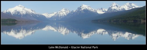
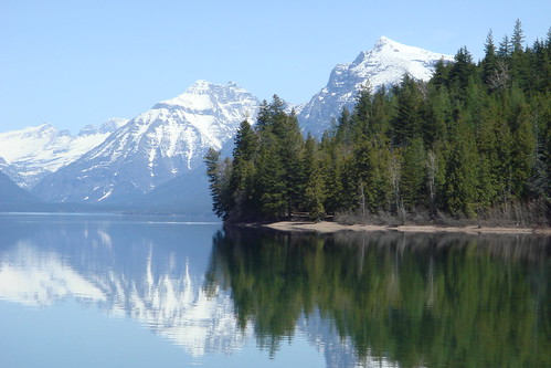
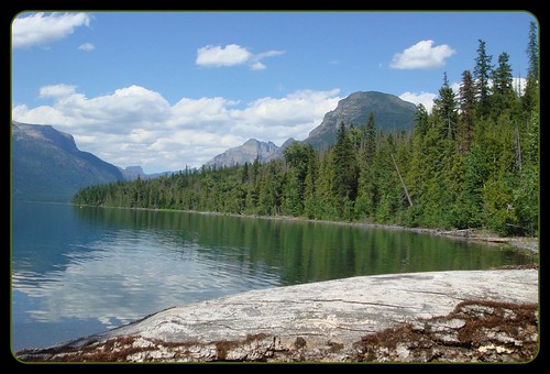
There are eight major lakes and 175 miles of fishing streams.
Tribal permits are required and guides are available
through Fish, Wildlife & Parks. The tribe operates four campgrounds.

Blackfeet Nation
P.O. Box 850 Browning, MT 59417
406-338-7521 or
406-338-7522 Fax: 406-338-7530
www.BlackfeetNation.com


Blackfeet Nation ECONOMY
A manufacturing plant on the reservation
produces pencils, pens and markers.
Several other businesses operate under Siyeh Development, Inc.


Major uses of the land are ranching and farming.


The principle crops are wheat, barley and hay.


www.BlackfeetCultureCamp.com
See local Blackfeet historic sights, such as buffalo jumps, tipi rings, pow wows and the Museum of the Plains Indian, or enjoy horseback riding, fishing and Rocky Mountain hiking in Glacier National Park. Spend the evening hours around the campfire learning about Blackfeet culture, listening to stories, drumming and singing. Meet our little herd of Spanish Mustang horses (original Indian horses) and enjoy walking and relaxing on the prairie, in glacially formed foothills and in the Rocky Mountains where the Blackfeet people have roamed and lived for many centuries.

Our lodge, tipis, and gallery are located on two hundred acres of pristine prairie with a spring fed lake 2.5 miles west of Browning, Montana on Hwy 89 and just a few short miles east of Glacier National Park. Great Falls and Kalispell, Montana are nearest airports. The closest international airport to us is Calgary, Alberta, Canada.
Native American Tribute


Polson Montana Golf

Northwest Montana Golf
Polson Country Club


Golf Course: Facility Use
Polson Country Club
406-883-8230
Tee times for the 18-hole course at the Country Club may be reserved up to two days in advance. The 9-hole course operates on a first come, first serve basis. Groups of 11 or more players may reserve tee times further in advance and are subject to an advance deposit. Use of the restaurant banquet facilities may be reserved with the food and beverage manager at 883-0259. A cleaning deposit will apply. User fees apply for all Country Club facility uses.

Golf Course: General Rules
Polson Country Club
406-883-8230
Polson Country Club is open to the public daily during daylight hours, weather permitting. All players must register at the golf shop prior to beginning play. Non-golfing children under the age of 12 must remain in a motorized golf cart for safety and liability reasons. A valid driver’s license is required to operate a motorized golf cart. Selling of goods and services by non-contracted individuals is prohibited. Bicycles, skateboard, roller-skating, jogging, non-golf related walking, metal spikes, person alcohol, strollers and pets (except those assisting special needs individuals) are also prohibited


Whitefish Montana Caviar

www.WhitefishCaviar.com
Mountain Lake Fisheries specializes in lake whitefish products. The clear unpolluted lakes of northwest Montana make possible the production of what experts consider to be the finest Golden Whitefish Caviar and Whitefish Fillets available in North America.

Of the several whitefish products we produce, the most unique is our Golden Whitefish Caviar. The distinctive rich apricot hue of our caviar is reminiscent of a Rocky Mountain sunrise. Because of its origin in pristine waters, its slightly crunchy texture, and its mild non-fishy, non-bitter flavor, many experts agree that the quality of our caviar is truly superb. Because of their favorable impressions, our caviar enjoys the enviable distinction of being served on numerous occasions at the James Beard Foundation in New York City, the most prestigious chef's organization in this country.
To assure our out-of-state customers of the utmost quality, our fresh-frozen “malossol” (low salt) caviar is shipped by one-day air in insulated packaging. By shipping our caviar frozen, the customer is given the option of either holding it in frozen storage or of thawing it for immediate consumption or sale. Our caviar freezes extremely well and has a frozen shelf life of more than a year. We are capable of either shipping directly to our retail clients or to their friends or customers. We eagerly invite you to taste our caviar and determine its unique merits for yourself. We think you’ll be very pleasantly surprised.

Eureka Montana Real Estate

Home on 20 acres in Eureka Montana 2 bedroom 2 bath with bonus room
$399,000

South of Eureka
www.TenLakesRealty.com
for More Photos and Information
or email us at
SavvyBroker@MontanaSky.com


Video Of the View from the Property

____________________________________________

Northwest Montana Waterways

Northwest Montana Rivers Wild Hang on
Here We Go
Enjoy the beautiful waters and wonders
of the backcountry of Northwest Montana.